Highway Mania: Snapshots of Cairo’s Sociopolitical Contradictions
Nermin Dessouky
The urban identities of Greater Cairo are overwhelmingly diverse, from an aging historical core, and informal urban sprawl to elite suburbs and failed satellite cities. Keeping these different parts connected is a network of ever increasing elevated urban highways 1 being built by the government. These highways are not only a tool for mobility, but they play a vital role in supporting and reproducing Cairo’s sociopolitical contradictions.
On the face of it, elevated highways might be justified as a tool for traffic flow and economic prosperity. Yet, a closer look explains how they might be failing to do these assigned roles. In fact, elevated highways can be economically draining on the long run. The increasing number of elevated highways in Egypt means an increase in the costs of regular maintenance to keep these highways safe. With an estimated life span of 50 to 70 years, elevated highways tend to reach functional obsolescence, demanding huge budget allocations to keep them safe. 2 In 2014, there was an estimation of 700 bridges in Egypt that had exceeded their lifespan and were at risk of collapsing due to the lack of regular maintenance. 3 Further, the effectiveness of highways as a tool to relieve congestion is questionable. Research indicates that increased provision of roads rarely succeeds in relieving congestion. 4 In many cases, new highways temporarily reduce congestion, but induce more traffic demand so the initial benefits from congestion relief fade within a decade. 5
Cairo’s highway mania might not make sense economically or functionally, yet they play a wider role beyond their material presence. This essay argues that the increasing felt presence of elevated highways in Cairo is driven by political motives rather than functional motives. The arguments presented in this essay are embedded in a wider literature on the politics of infrastructure. In particular, Brian Larkin has shown that building infrastructure projects has multiple motives beyond their physical or technical role. A technical role is of minor significance compared to their ability to convey a sense of awe and fascination to the public. Some projects might not be viable economically, but they act as symbols of modernity, progress, and state power, making them a worthy investment. 6 For instance, Penny Harvey and Hannah Knox's anthropological work in Peru demonstrates how mega road projects elucidate the state’s priorities. The location of these road projects reflects the uneven experience of state presence in different areas. 7 In Cairo, Deena Khalils’ work on water shows how investing in infrastructure is intertwined with asserting the presence of the state. 8 Infrastructure tends to be thought of as an invisible investment. Roads, however, are a distinct type of infrastructure that has an affective presence.
To better demonstrate the sociopolitical role of Cairo’s elevated highways, this essay first starts by tracing Cairo’s urban development policies in the last fifty years, which I situate within the international appetite for highways. In the remainder of the essay I look at two famous highways in Cairo, the case of Saft El Laban Corridor and the 15th of May Bridge. I discuss the sociopolitical implications of these highways by presenting three contrasting snapshots of exclusion, surveillance and usability. Instead of evaluating them on the basis of traffic flow I highlight their functioning role in supporting and reproducing many urban ills.
The Highway Appetite: Egyptian devotion and western opposition
In the last fifty years, Egypt’s urban policies focused extensively on developing road networks. This makes many Egyptians sarcastically refer to this period as an era of roads and bridges. The rise of Egypt’s highway policies became paramount in the 1970s when the high commission of Cairo developed a master plan of Greater Cairo. The plan proposed major urban highways cutting through Cairo in different directions. Highway proposals were coupled with plans for new satellite cities in the desert surrounding Greater Cairo. These plans aimed to relieve the stress on Cairo’s road network and ease access to the new satellite cities by crossing over Cairo. 9
Almost forty years later, Cairo is currently famous for its multiple urban flyovers. Under different government regimes, the focus on developing and investing in roads and bridges has remained a top priority. During Mubarak’s regime, Cairo 2050 —the government’s strategic master plan—proposed the creation of 1,000 km of roads and 14 new highways cutting through the city to link the inner and the outer areas of Greater Cairo. 10 Most of the Cairo 2050 plans never came to be, yet the current regime has continued in the same policy direction by initiating The National Roads Project with a budget of EGP 36 billion and a goal of 5,000 km of new roads, mostly highways. 11
This local devotion for elevated highways in Cairo comes at a time when their utility is in doubt elsewhere. Although the first half of the 20th century witnessed western support for national highway projects, 12 the second half saw massive opposition from communities and urban activists. The resentment against highways emerged due to their social, environmental, and economic impacts. Elevated highways have been associated with negative health impacts, as well as a decrease in local economic activities and social well-being. Highways are also blamed for increasing suburbanization, promoting urban sprawl and land use adjustments. 13 In the United States, highways were used as a tool for exclusion and segregation, displacing poor neighborhoods. 14 Perceptions of elevated urban highways changed from a solution that enhances traffic flow to a monstrosity that casts a shadow on cities and decreases quality of life. 15 Instead of investing in elevated urban highways, many cities have revisited their highway policies and have prioritized revitalizing urban areas and mass transit. Cities such as Seoul (South Korea) and Boston (United States), among many others, have replaced their elevated highways with parks, boulevards and tunnels. 16 Most of these decisions simply reflect a shift in the priorities of urban policies.
While elevated urban highways fall out of favor in international practice, they continue to be pursued with high fervor in Cairo. On the face of it, these projects are publicly appreciated for alleviating traffic congestion. However, this general appreciation might be representing a chosen few, as in 2017 only 4.7 million Egyptians have registered private vehicles, 17 . Are Cairo’s elevated urban highways welcomed by everyone? Who do they cater to? Which urban values do they support? To answer these questions, I explore two elevated urban highway projects located in two different contexts. The first is the 15th of May bridge located in Zamalek. Zamalek is an affluent district known for its high-end restaurants, fancy boutiques, international organizations, and embassies. Geographically, Zamalek is an island in the Nile which makes it central to facilitating traffic between the East and West of Greater Cairo. The 15th of May Bridge, a 2.5 km long elevated highway, was built between 1980 and 1985, crossing over the Nile and cutting thorough Zamalek.
The second case I examine is the Saft El Laban corridor. In contrast to Zamalek, Saft El Laban is an informal area that was previously a prime agricultural village. These agricultural lands were gradually replaced by concrete multistory residential buildings constructed using informal subdivision processes, turning Saft El Laban into a heavily populated area. With the construction of the city’s Ring Road, the location of Saft El Laban became strategic between Cairo University and the Ring Road, which has transformed its local road into a major traffic axis. The Saft El Laban Corridor was built between 2007 and 2010, as a two-level 4.5 km long elevated highway that stretches over the district’s main road.
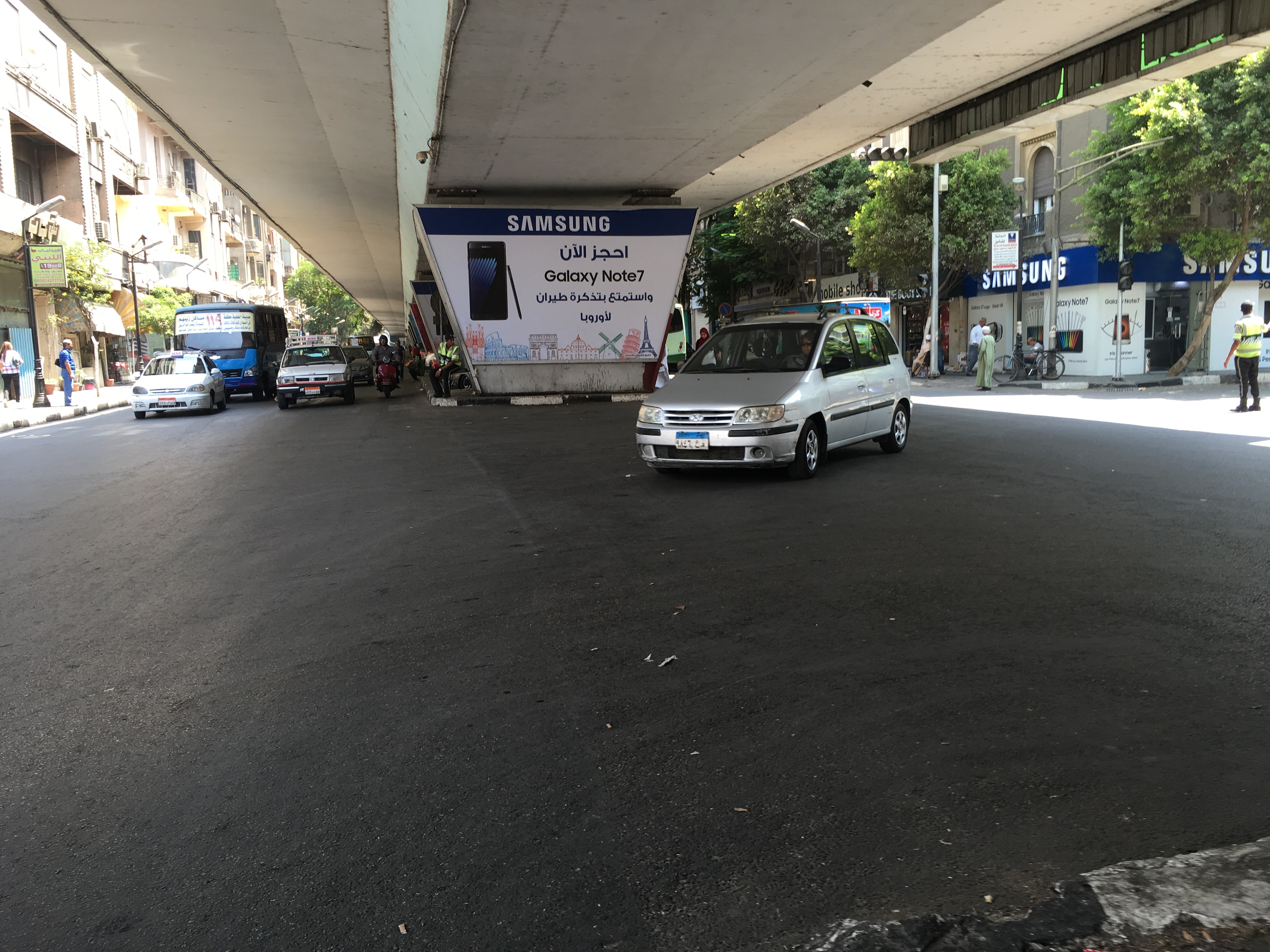
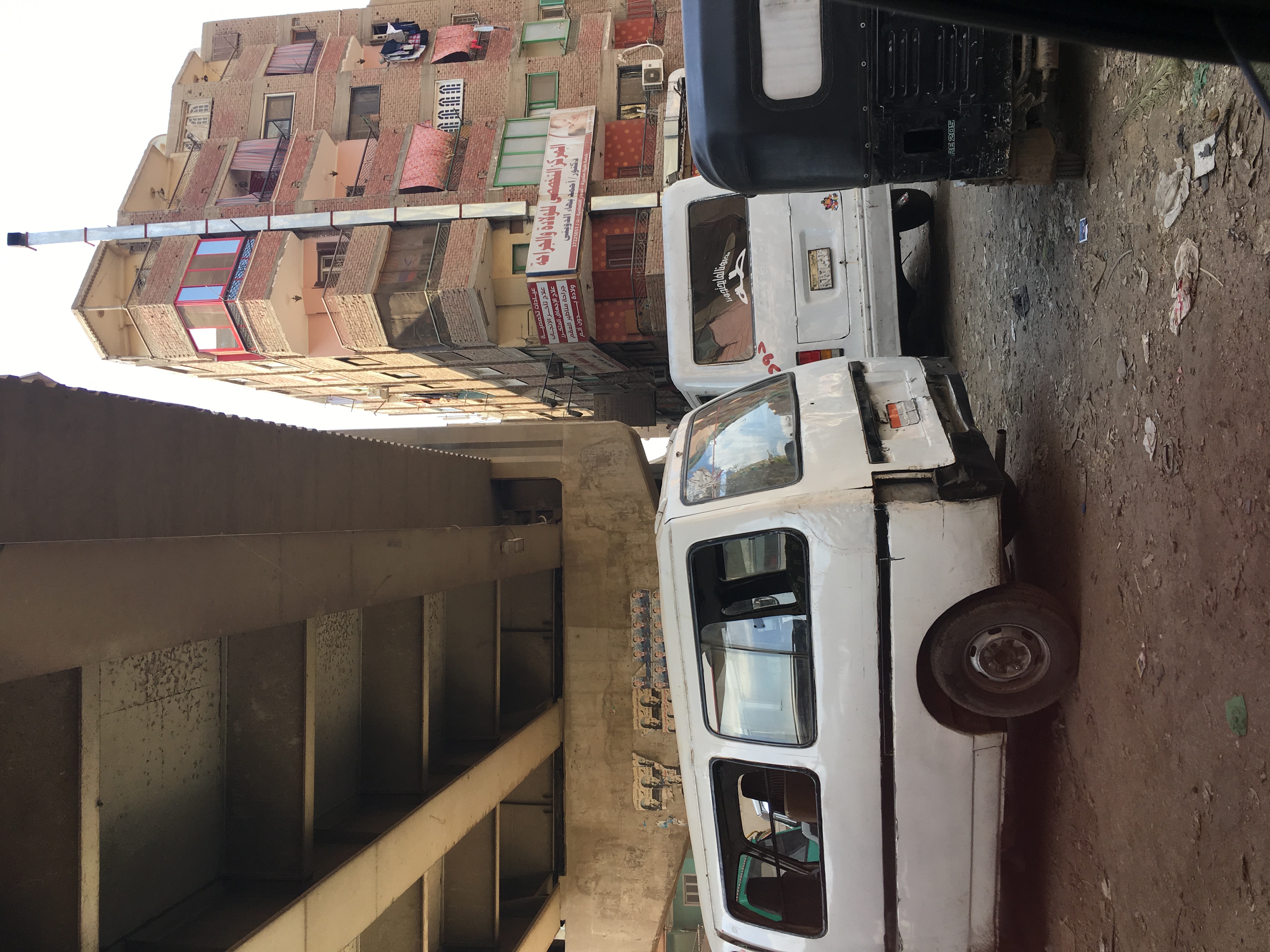
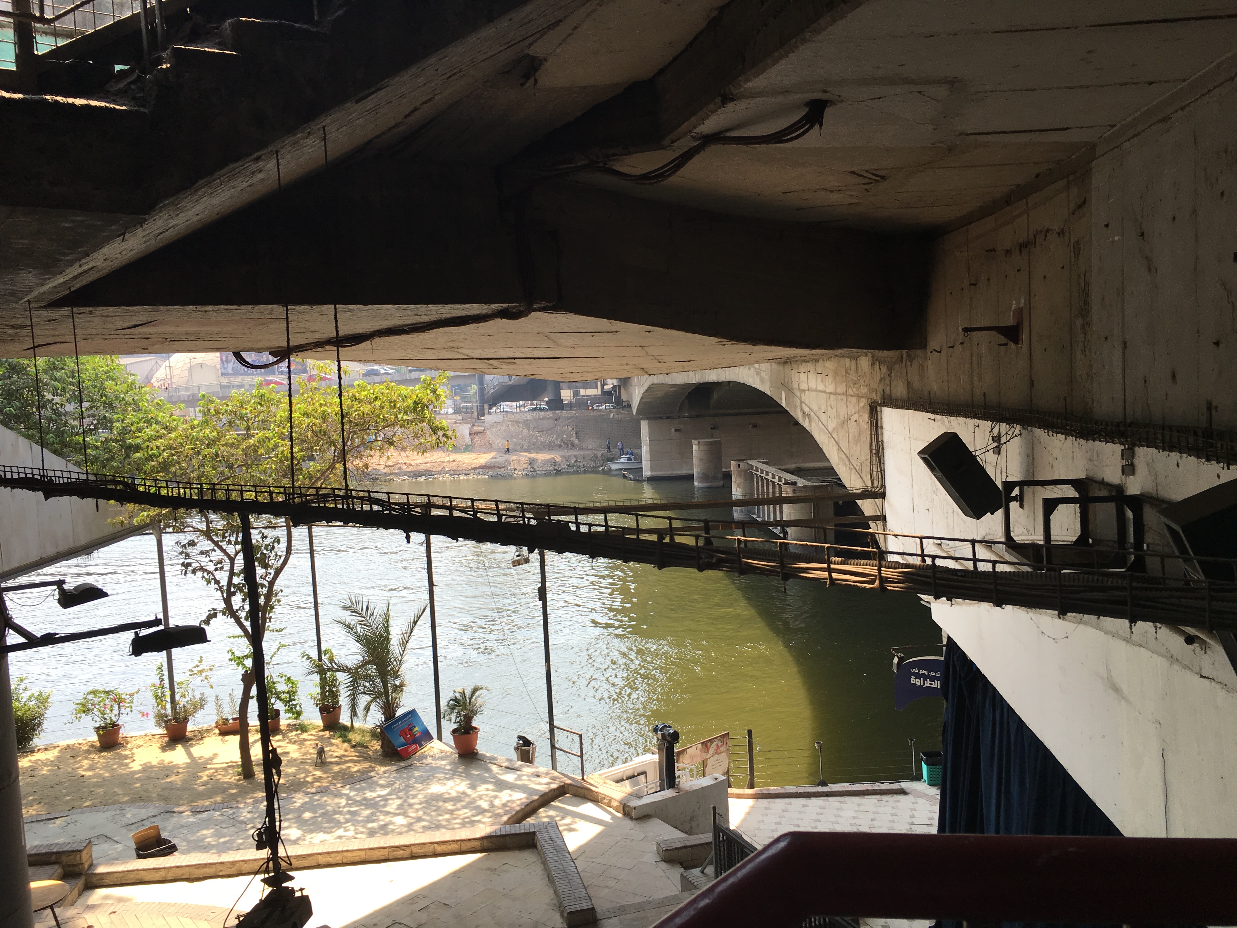
A total of 14 in-depth interviews were conducted in both locations during the summer of 2016. The interviews targeted residents and shop owners who live or work in buildings directly overlooking the elevated highway in both locations. Purposive sampling was used at the beginning to identify a potential participant in each community who is in direct contact with the elevated highway. After the identification of the first potential member, a snowballing technique was used to identify further participants. In both cases, elevated highways were built in close proximity to the existing buildings, leaving only a few meters between the buildings and the highway (see figures 1 and 2). The following sections follow how these two similar structures were utilized and conceptualized in contrasting patterns, illustrating Cairo’s contradictory modern urban ills.
Social Segregation: visibility, invisibility and exclusivity
Elevated highways have been typically associated with underprivileged communities in many cities of the global North. 18 As highways lower the quality of life significantly in areas that they pass through, unprivileged areas with no political influence are seen to be less successful in resisting such plans. In a city like Cairo, with little to no public participation in urban plans, both high-end and low-end areas get their share of elevated urban highways. The centralized, top-down urban planning approach adopted in Egypt 19 leaves little room for local communities to resist new projects. While equally having no say in the matter, residents of Zamalek and Saft el Laban conceptualized the importance of the elevated highway to their areas differently.
For the residents of Zamalek, despite associating the 15th of May Bridge with the general socio-political degradation of the district, the presence of the highway was seen as crucial. “If you can build another layer of the bridge to lift more traffic, it will be great, at least it is protecting ElZamalek from through traffic," said Zeyad 20 a resident of Zamalek, when I asked him if he can imagine the area without the bridge. As a central island that is used to bridge traffic commuting between the eastern and western parts of Cairo, Zamalek often experiences a high ratio of through traffic. The residents appreciate the fact that the bridge elevates some of this traffic, leaving the local roads to the residents and their visitors.
Although highways are commonly described as negatively impacting business because they take away potential passer-by customers, this does not seem to be the case for Zamalek. Mohamed, the owner of an antique store, explained to me that "Zamalek is a destination, we are self-sufficient, and people come to us”. For the residents of the area, the presence of the elevated highway left the local streets for the locals or visitors. Instead of feeling hidden by the highway, the district was perceived as self-sufficient and better without uninvited visitors.
Residents of Saft El Laban, however, saw the highway as further facilitating their exclusion, as commuters unseeingly fly over their area. According to a resident, Ali, the main road had been a vital axis for people commuting between the 6th of October city and central Cairo. This caused authorities to continue to maintain the main road, making sure it was properly paved, cleaned and secured. After the construction of the elevated highway, all major traffic moved into the air. This meant that commuters now avoided Saft El Laban physically and visually. The main road underneath became one that is used only locally, which demotivated local authorities from its maintenance. Ahmed articulated this transition by explaining that the government shifted its attention to the elevated corridor and left the local road to be controlled by local people. He further notes that once the land was secured to build the elevated highway, authorities stopped caring about what is under the corridor, leaving the maintenance to local residents' efforts (See figure 3). This decisive shift caused even informal transportation systems that used to pass by Saft El Laban, to use the elevated highway, leaving the area with little to no means of transportation. In the words of Hanan: “We feel like we are buried under the corridor”. Other residents described the highway as a solution that does not benefit them and simply benefits car owners above them.
Consequently, these two structures can be described as an exclusionary tool albeit in different ways. In Zamalek, this exclusion is much welcomed and celebrated. While the residents blame the highway for invading their privacy and degrading the urban quality of the beautiful island, they can no longer imagine Zamalek without it. In Saft El Laban, this exclusion underlines the extended geographical and political marginalization of the area, leaving the residents of Saft El Laban in the shadows; physically and metaphorically.
State Surveillance: blind spots and observation towers
Highways tend to be linked to authoritative regimes because they ease state intervention. Maintaining an extensive and high-quality road network can be a priority for military regimes to assume more geographical and strategic control. 21 The presence of an elevated structure overlooking a dense district creates vertical urbanism that implies hierarchical differentiations between those who can control from above and those who control from below.
During the past eight years of political unrest in Egypt, the elevated highways of Saft El Laban and Zamalek played vital but drastically different roles. As a relatively affluent area with many embassies, there was a heavy presence of security forces to maintain the safety and security of Zamalek. For example, Amr, a shop owner, explained that “it is safe, the police are always overlooking the spaces under the bridge to make sure no one breaks the law…the area is full of embassies, so we are well protected”. Yet, this sense of safety and protection was disrupted in different instances due to the presence of the 15th of May highway. Laila, the owner of a building overlooking the highway, described it as the security blind spot of Zamalek. In her interview with me, she recalled how some groups used the elevated highway as a platform to throw explosives on the streets during times of protests and political unrest. In other instances, armed individuals used the platform to shoot others on the lower levels. The well-secured nature of Zamalek and its geographical attributes as an island makes the elevated highway one of its few security vulnerabilities.
This sense of security is starkly different in the case of Saft El Laban. “The government does not exist in Saft El Laban,” said Sayed who is a resident there. As previously noted, residents feel that the presence of the government evaporated after the highway’s construction, making it an infrastructure that paradoxically allows security forces to have upper hand control over the area without being physically present there. Any protests or political unrest happening in the local roads of Saft El Laban can be overseen by security forces that position themselves over the highway. As Said succinctly articulate: “They use the highway for hunting and controlling the protests happening under it”. As a popular neighborhood with a high population density and mostly narrow, dead-end unpaved roads; gaining control over Saft El Laban is challenging for security forces. In this case, the elevated urban highway acts as a helpful observation tower for the state.
Using elevated highways for security and surveillance purposes does not happen only in Saft El Laban, but it is also a recurring scene on many elevated urban highways in Cairo. Convoys of prominent authority figures are usually accompanied by a concentration of security forces, using elevated highways as observation towers. This intricate relationship between these flyovers and surveillance has become increasingly normalized in the everyday lives of Egyptians.
While urban struggles are usually conveyed as horizontal struggles 22 , elevated highways introduce a vertical dimension to the struggle over space. In the cases of Zamalek and Saft El Laban, notions of urban surveillance or social exclusion do not only take place horizontally, but they are also created vertically, giving more power to those who can claim the upper hand.
Negotiated Spaces: entrepreneurships and encroachments
The popularity of elevated highways is typically associated with their ability to create traffic flow, which is only experienced by drivers. However, this smooth surface flow created on the top creates a series of road obstructions below. For residents, bridges and flyovers mean bulky columns that cut through the urban fabric, creating dark and ambivalent spaces underneath. Both the residents of Zamalek and Saft El Laban expressed ambiguity with regards to who own these voids, or which specific authority is responsible for them. My two case studies illustrate the wide differences in the uses of these spaces.
In Zamalek, most of the spaces under the 15th of May Bridge are currently used as profit-generating schemes. Hassan, an old resident of the neighbourhood recalled how the local authority tried to generate money in different ways: by renting spaces to flower kiosks or leasing larger areas as parking spaces. Hassan explained that in one instance the local government collected money from shop owners to lease the spaces as private parking spots, but the traffic authority eventually did not allow parking. This left residents unsure about which institutional entity has legal control of these empty spaces.
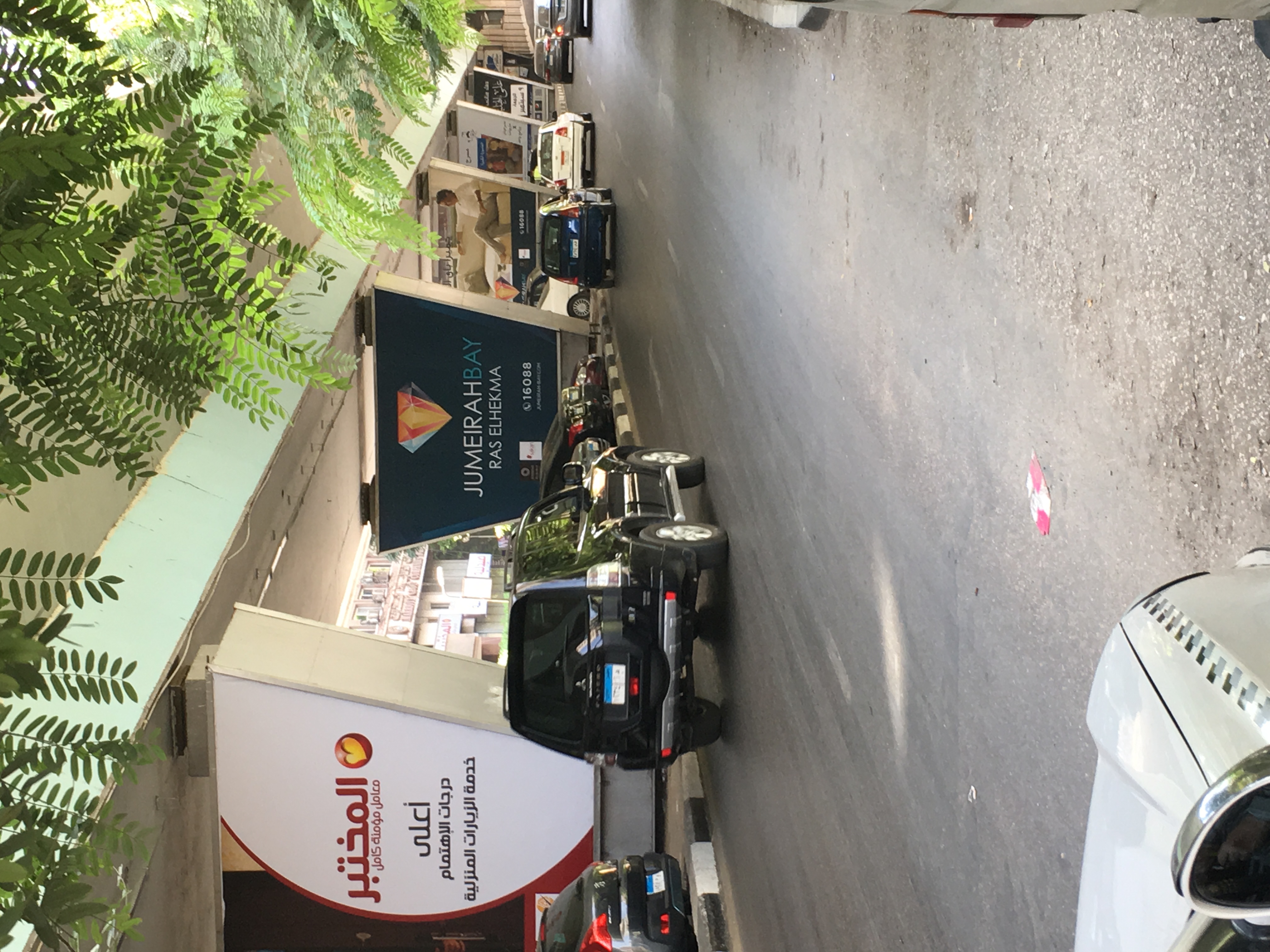
In addition, column structures carrying the highway currently act as billboard space for advertisement agencies. Although residents understand that some type of government entity owns these spaces, yet, they also tended to refer to private advertisement agencies as responsible for the space. For example, Omar explained to me that the space under the flyover used to be full of waste, but an advertisement agency approached the local authority asking for the right to use the columns for advertisement. The local authority welcomed the idea, and they regarded it as beautification to the area. In exchange for this right to advertise, the advertisement company contributed financially towards the costs of street maintenance. For Omar, this seems like a good deal: the agency puts up its advertisements, and at the same time its billboards provide extra street lighting and they make sure the area remains clean; a win-win situation for Zamalek residents (see figure 4).
Empty spaces could also be repurposed towards other ends. For instance, Tamer, an owner of a fabric store, described Zamalek as a cultural hub that embraces art. For Tamer, spaces under the bridges and flyovers have great potential to be used for art shows and concerts. During our interview, Tamer pointed towards the edge of the island and explained how it previously brimmed with waste. Yet, a businessman saw its potential and offered a clean-up in exchange for the right to turn it into a cultural venue. The local government welcomed the idea and the venue is now nestled under a bridge at the edge of Zamalek overlooking the Nile (see figure 5). It is a semi-permanent structure that acts as a cultural node under the name of El Sawy Culture Wheel. The Wheel currently attracts visitors from all over Cairo, and hosts art exhibitions, musical performances and similar activities.
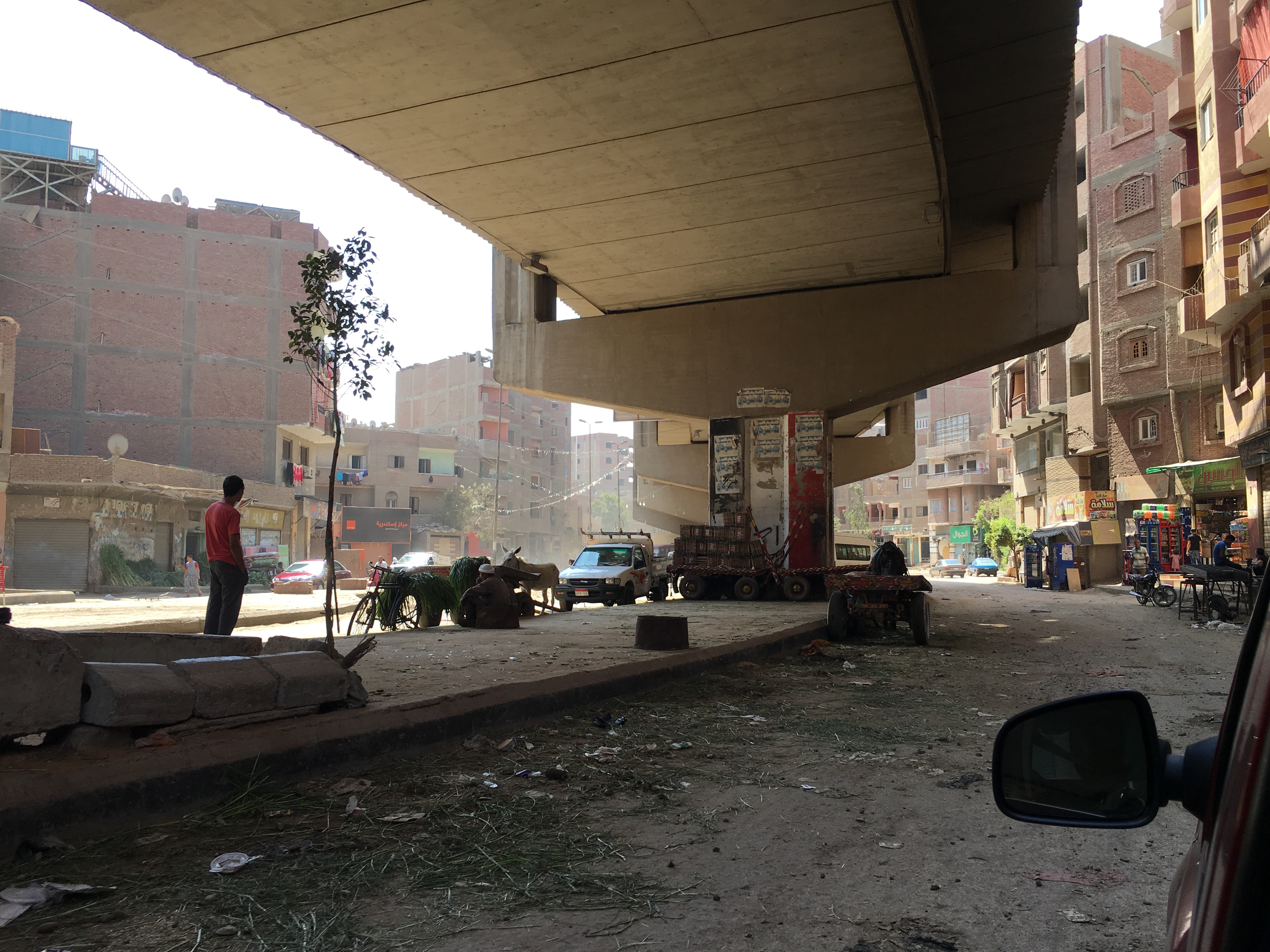
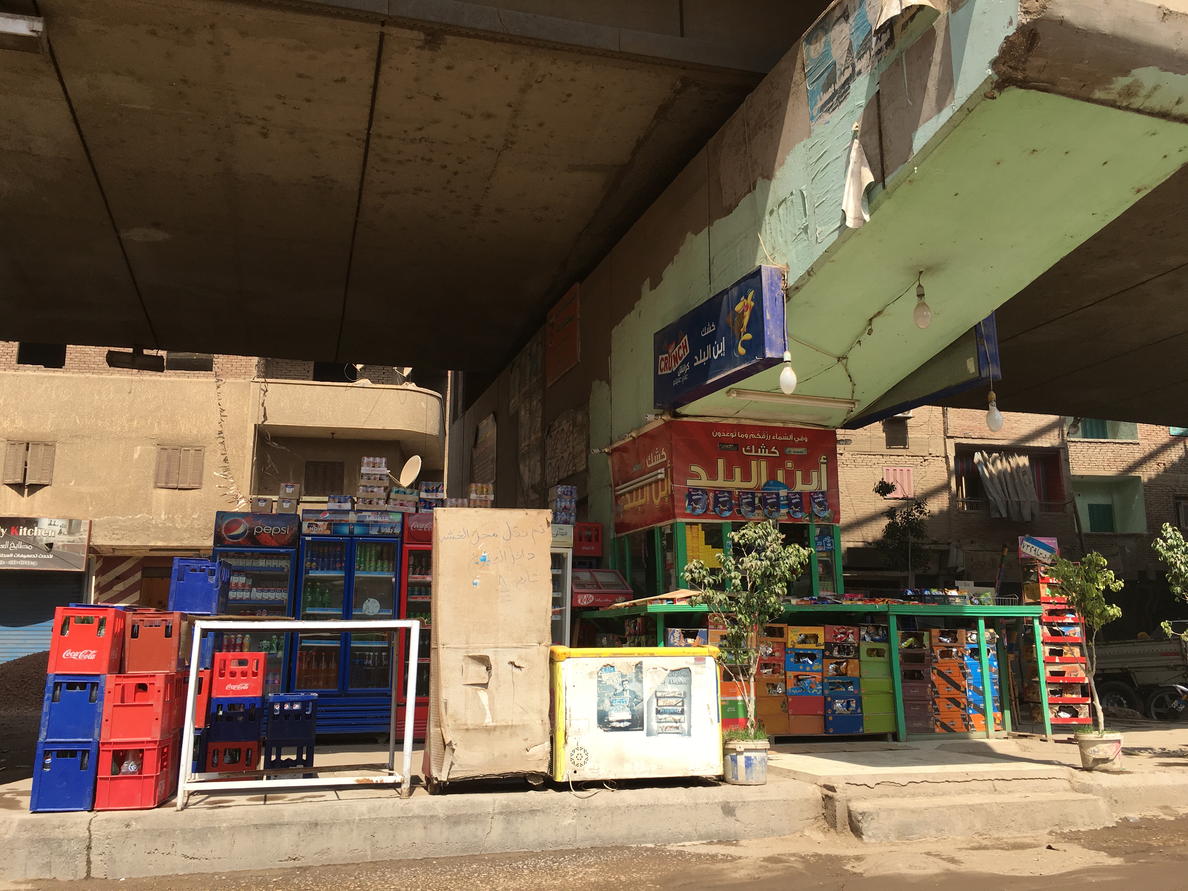
This creative and entrepreneurial use of the spaces under the flyovers can also be noticed in Saft El Laban, yet with less formal support. The informality of Saft El Laban is linked with the scarcity of planned land for development. Until recently, most of the land was zoned as agricultural. The fast and informal urbanization that took place in the area was mostly for housing purposes, leaving no space for proper educational, health and commercial services. In a way, Saft El Laban can be described as a heavily urban district but with the restricted services of a rural area. These conditions make the empty spaces under the highway very attractive for developing commercial uses. In my interviews for example, Ahmed explained that, “the local authority owns the space in theory, but they don’t really exist in Saft El Laban”. This absence has meant leaving the space to be controlled by the local communities. Residents have, thus, developed their own system to approve and provide permissions for space use. For instance, the owners of a building overlooking the elevated highway need to grant the business owner their approval to legitimize his business. Fathy explained the rationale of this arrangement: “I am the one who allows people to take the space in front of me, it is my right … it is an unspoken rule … I can't open my window and find someone taking over the space in front of me, he might be invading my privacy, so he can’t do that without getting my approval.” Fathy further explained that each zone under the highway was controlled by a specific family, and activities could not take place without receiving that family’s blessing.
Several types of activities can be noticed under the corridor. These range from car repair workshops, to kiosks, coffee-shops, storage spaces, parking, meeting spaces, and animal corrals. Although these activities tend to be semi-permanent and are creatively developed to use the shade and structure of the elevated highway (see figure 6), they have not succeeded in reaching a formal arrangement with relevant authorities to guarantee permanence. As one of my interviewees explained "the employees of the local authority pass every once in a while to threaten to remove these encroachments, but they are easily bribed”.
Residents perceive these spaces as a place with high potential and easy access as they could host many services that are lacking in the area. Some residents of Saft El Laban expressed that they were willing to fund the construction of spaces under the highway to provide health or educational services to the community. However, their inability to make any formal agreement with the local authority makes them worry that such spaces can be removed any time. As Ehab summarized “the problem lies with getting approvals”. He further explained that the local authority tends to ignore personal activities that happen under the elevated structure, but collective initiatives tend to be demolished.
As such, there is always ambiguity about what is or not allowed to exist under elevated structures. It is not always clear to residents if activities are accommodated due to the type of use proposed or the perceived social standing of the initiators. The relationship between authorities and the community in both cases signify a grey area of governance in the formal/informal dichotomy. Notions of formality, territoriality, and ownership all emerge in conversations on these un-defined spaces under the elevated highways. The existence of such vague areas fuels ongoing state-society contestations for claiming use, responsibility and control.
Extending Social Disconnections
In terms of physical distance, Zamalek and Saft El Laban are less than 9 km apart. Both districts have experienced an elevated urban highway passing directly over and through them. However, how these structures have been utilized and their impacts speak directly to many urban dilemmas in Greater Cairo. Interviews in both locations reveal that communities suffer from the prevailing negative impacts associated with highways like an increase in pollution, noise, urban degradation, privacy interference, and an alternation of the urban identity. However, beyond these common symptoms, there are clear distinctions in the relative importance of the highways and the ways communities and authorities appropriate and discipline these spaces. In Zamalek, a highway is a profit generator and keeps out unwanted visitors in the exclusive area. In Saft El Laban, a highway is a tool that facilitates neglect. It does not only block out the sun and air, but also blocks opportunities for state and public attention.
As mentioned above, it is now widely acknowledged that building highways can absorb a lot of money while failing to relieve congestion and ruining inner-city cores. 23 However, highways are used to project not only technical effects, but also expectations and dreams. This essay has attempted to draw on a few scenes of contestation over different perceptions, values and uses amongst various social groups. For the regime, elevated urban highways can be used as a tool for control and urban surveillance. For the underprivileged, it is a tool that assures their exclusion and invisibility. And, for the affluent, it is be a tool to protect the exclusivity. These scenes offer a glimpse of the sociopolitical impacts that elevated highways have on the two neighborhoods and also serve as a starting point of understanding their proliferation and their failing promise to control traffic flow.
I think of Cairo’s new highway projects as tools that showcase growth, progress, and national pride. A notable example is the recent opening of Rod El Farag's suspended bridge, which has been used as a demonstration of state sovereignty. In 2019, according to the Guinness World Records, the project became the world's widest cable stayed bridge, and surnamed the Tahya Masr Bridge (Long Live Egypt). The extravagant bridge crosses over the impoverished Waraq Island, home to roughly 90,000 residents occupying undeveloped lands. With six lanes in each direction, shiny suspended cables, and a glass pedestrian walkway, the bridge was promoted by the media as a destination to be visited and celebrated by locals and tourists alike 24 Following this success, several elevated urban highways are planned to cut through Cairo’s urban fabric. The latest is a network of newly built bridges over Heliopolis, an early 20th century high-end district that boasts of many architectural gems. Drowning objections from residents and experts, the new bridges in Heliopolis continue to be built, bulldozing the neighbourhood’s beautiful streets and uprooting hundreds of trees. 25
In retrospect, at best, these highways might temporarily facilitate mobility in a city with hectic traffic. They project the illustration of a country in progress and bolsters the image of the ruling regime. They represent a quick return on investment in terms of social propaganda, in comparison to investment programs in health, education, mass transit and other welfare programs. However, these elevated urban highways are more than technical solutions or failures. They are a critical site for the assemblage of power and actors that are materially intertwined with their socio-political contradictions.
Author
Nermin Dessouky is a Ph.D. Candidate at the University of California, Davis. As an architect, with an MSc in Sustainable Development from the American University in Cairo, Nermin uses systems thinking to navigate conflicts in design use values between different actors. Her work focuses on monitoring and evaluating the social impacts of the built environment across different scales in the MENA region.
-
The common Arabic term is ‘Kabari’, which encompasses bridges, flyovers, overpasses, elevated highways and corridors; hence the appropriated term varies throughout the article depending on the context. ↩
-
Matthew E Kahn and David M Levinson, “Fix It First, Expand It Second, Reward It Third: A New Strategy for America’s Highways” (The Hamilton Project, 2011). ↩
-
Osman El Sharnoubi, “700 Bridges in Egypt Close to Collapse: Transport Official,” Ahram Online, 2014. ↩
-
Gilles Duranton and Matthew A Turner, “The Fundamental Law of Road Congestion: Evidence from US Cities,” American Economic Review 101, no. 6 (October 2011): 2616–52. ↩
-
Todd Alexander Litman, “Generated Traffic and Induced Travel,” Institute of Transportation Engineers Journal 71, no. 4 (2001): 38–47. ↩
-
Brian Larkin, “The Politics and Poetics of Infrastructure,” Annual Review of Anthropology 42, no. 1 (2013): 327–43. ↩
-
Penny Harvey and Hannah Knox, Roads: An Anthropology of Infrastructure and Expertise, 1 edition (Ithaca ; London: Cornell University Press, 2015). ↩
-
Deena Khalil, “The Flexible Governance of Water in Cairo’s Informal Areas,” Water 11, no. 8 (August 2019): 1644. ↩
-
Keith Sutton and Wael Fahmi, “Cairo’s Urban Growth and Strategic Master Plans in the Light of Egypt’s 1996 Population Census Results,” Cities 18, no. 3 (June 1, 2001): 135–49, ↩
-
Ayman El-Hefnawi, “Cairo Vision 2050: The Strategic Urban Development Plan of Greater Region.” ↩
-
Lolwa Reda, “2018 Accomplishment: National Road Project Puts Egypt 75 Globally in Road Quality,” EgyptToday, December 28, 2018 . ↩
-
Projects such as the highway act in the US, the Autobahn in Germany and the Autostrada in Italy. ↩
-
Nathaniel Baum-Snow, “Did Highways Cause Suburbanization?,” The Quarterly Journal of Economics 122, no. 2 (May 1, 2007): 775–805. ↩
-
Sarah Schindler, “Architectural Exclusion: Discrimination and Segregation Through Physical Design of the Built Environment,” The Yale Law Journal 124, no. 6 (2015): 1965–1969. ↩
-
Francesca Napolitan and P. Christopher Zegras, “Shifting Urban Priorities?: Removal of Inner City Freeways in the United States,” Transportation Research Record: Journal of the Transportation Research Board 2046, no. 1 (January 2008): 68–75. ↩
-
Juan Pablo Bocarejo, Caroline LeCompte, and Jiangping Zhou, “The Life and Death of Urban Highways” (Institute for Transportation & Development Policy and EMBARQ, 2012). ↩
-
CAPMAS, “Statistical Yearbook” (Central Agency for Public Mobilization and Statistics, 2019). ↩
-
Sarah Schindler, “Architectural Exclusion: Discrimination and Segregation Through Physical Design of the Built Environment,” The Yale Law Journal 124, no. 6 (2015): 1965–1969. ↩
-
Kareem Ibrahim, “Post-Revolutionary Urban Egypt: A New Mode of Practice?,” Égypte/Monde Arabe, no. 11 (April 6, 2014): 237–66. ↩
-
Names throughout the article have been changed to maintain confidentiality. ↩
-
Albert Saiz, “Dictatorships and Highways,” Regional Science and Urban Economics 36, no. 2 (March 1, 2006): 187–206. ↩
-
Stephen Graham and Lucy Hewitt, “Getting off the Ground: On the Politics of Urban Verticality,” Progress in Human Geography 37, no. 1 (February 1, 2013): 72–92. ↩
-
Bocarejo, LeCompte, and Zhou, “The Life and Death of Urban Highways.” ↩
-
Ahmed Morsy, “Tahya Masr Bridge: Breaking the Record,” Ahram Online, May 22, 2019, sec. Egypt/Politics. ↩
-
Mounir Christine, “Trees Razed for Bridge Construction in Heliopolis,” Egypt Independent, August 7, 2019.


